We came back to the chalet and decided to watch Indiana Jones. Ever since the West Coast Trail, where we were humming the theme to the movie, we wanted to watch it. Well, we tried but I think we all fell asleep. But we did wake up from our nap in time to fit in another hot tub session and watch the Habs game while cooking a mean barbecue. Man, cycling across Canada is really tough.


If there are two words I can use to describe today they would be ladders and mud! (and lots of them!). We definitely had a late start this morning! I woke up around 8, and the two boys probably closer to 9. By the time we left, EVERYONE else at the camp had left at least an hour before (most more like 2+hrs before. We hit the road (or the trail i guess?) around 11:30am. The morning was BEAUTIFUL, and we started with a nice beach walk! It was a quick paced walk, and we were covering a lot of distance. We needed to make it to Camper's Bay in order to guarantee we would see Owen's Point tomorrow morning. Although it was only 16km away, there were rumours floating around that after the 53km mark (the time-wise half way point, some would say), we would be very slow going. The first people we bumped into in the morning were three avid hikers. You could tell how avid a hiker is by his/her walking stick. Although we were authentic and resourceful and environmental and chose driftwood walking sticks, this does not speak highly of our hiking abilities. ANYONE can pick up a stick, but only a true hiker would spend money on something you could get for free. These three men were SO avid that they each had TWO purchased walking sticks each. They were a bit negative, saying we'd have a hard time making Camper's by nightfall (we were clearly being judged by our walking sticks). The next two ppl we bumped into were a lot more positive and warned us it was hard going, but that we'd definitely make it. We decided to ignore Two-sticks and listened to the positive encouragement instead. I must say though, although negative, Two-sticks did give us good advice. They told us to take the bush route at the next beach access point because Waldron was very deep, and the tide was coming in. When they crossed
the river the water came up to their upper thighs. It was solid advice (we later learned Sean did the river crossing and then proceeded to spend 1-2hrs just drying off). So we headed up into the bush (and were thankful for a change in scenery). The bush route was tons of fun! It was like an obstacle course, where there were roots everywhere, and pits of mud we had to maneuver in/through/around. There were a lot of ups and downs, and it was very interesting, made us think, and was just fun (had to jump, duck, climb over/under, etc). We had several cable cars as well to take us over rivers. Then the ladders started. We were warned about the ladders, but the warnings didn't quite give them justice. They were LARGE ladders. We were told they were 100ft deep/long (by Two-sticks.....and they would know). They never mentioned at the start of the hike that you shouldn't do it if you're afraid of heights. Good thing we didn't have that problem because these ladders were HIGH. And there were a LOT of them!!! They usually went down to a bridge (wood or suspension) or to a cable car. We were definitely wrecked by the end of the day! We didn't really find it got much slower at the 53km mark per say. It was more that once you hit a ladder, you would spend time and energy climbing down then up, but you wouldn't actually gain any distance. Once we were done the ladder section, we were a little worried that we would be caught out in the dark (having no concept how long it would take to complete the last 4km). By that point there were no more ladders, but there was still a LOT of mud to maneuver through (which needless to say is time consuming!). The sun was getting quite high in the sky, and we didn't give ourselves many (or any) breaks. By the time we hit Camper's we were WRECKED! We immediately started cooking dinner and setting up camp (and obviously taking off all our wet shoes/clothes). Turns out we had just enough sunlight. The sun started setting as we were washing up our dishes and it only became dark after we were all ready for bed! No one in the camp thought we were going to make it (because of our late start) but we won! (as if it was ever an option to not make it in time!).
We woke up at 6am today and were hoping to cover some ground, and were looking forward to some crab/salmon breakfast/lunch, and some burgers for dinner!!! Although we learned yesterday that the beach route was slower than the bush path, it was such a beautiful morning, and the Tsusiat point looked really cool in the distance that we decided to start the day with a beach walk. We would make an occasional side route to climb a boulder in the ocean.
them earlier, and they took the beach route while he took the forest. Therefore, we decided to stay along the forest if it was going to be quicker. It was really quick. The beach today had firmer sand, and smoother rock shelves. Therefore, we covered quite a bit of ground! We stayed on the beach until the path led into the forest via the lighthouse. It was a bit of a steep climb up to the lighthouse (where there was a really nice view!), then mostly downhill through the forest back to the beach. Michael and Travis took a bit of a side route that resulted in them getting wet trying to get back off the rocks (and then they had to detour back through to forest again just to make it back to the beach without being soaked head to toe by the ocean). There were three WOOFers working on the reserve (at Chez Monique's), who were still around, chilling out. They cooked us up a burger for dinner, and it was delicious! We then went to set up camp and build a fire. We finished off the smores and vodka and camped out under the stars. I went inside the tent part way through the night because my sleeping bag was getting a bit wet. The other two stayed camped out and apparently by morning, all their things dried (according to Michael, Travis was fast asleep all night and didn't notice anything wet at all).
We set the alarm for 7am this morning. By the time we had breakfast (oatmeal), and packed everything up and hit the road, Sean had already left. We set out, hoping to cover a lot of ground today. We were told that the first part of the trek was easier and although it's a 75km route, the 53km mark is halfway time-wise. Therefore, we wanted to cover as much ground during the easy segment as possible. Unfortunately that didn't quite happen. In total today, we only covered 11km. Most of the trail today was along the beach and it was SO slow going! We had to walk over a rock shelf for parts, which wasn't too bad, but when we had to walk on the sand or gravel it was as if with every two steps forward, we were taking one back. It was SO slow going, we were so happy when we finally were able to take the bush path! It was still a nice day, but overcast at times. By the time we got to our camp it was beautiful again!
falls). There was some wicked camping on our side of the stream already, so although we wanted to scope out the other side, we left our packs behind. The water was REALLY cold, so at first (partly for comfort and partly for a challeng) we started making a bridge. There was a lot of driftwood, but the stream was moving too fast, and it proved quite difficult to do. How many ppl does it take to build a make-shift bridge? Apparently more than 2 engineers and 1 carpenter. We gave up not long after starting and rolled up our pants and crossed the FREEZING water. Michael found some random skull. We tried guessing, but don't have a clue what animal it could have come from!
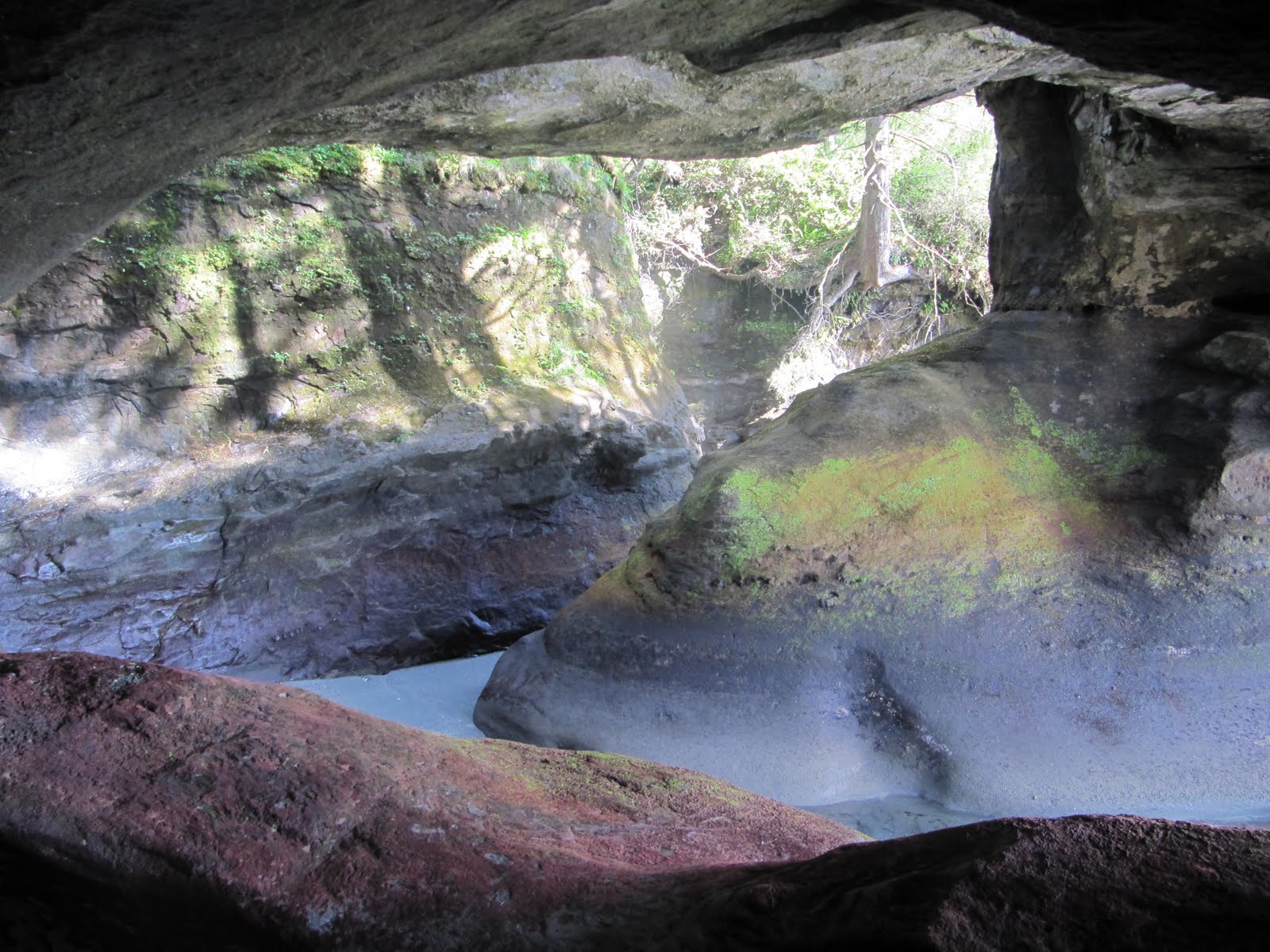
Although the other side did have the washrooms and bear lockers, Our original side had a cave we could camp in, and some wicked large rock formations that blocked some of the wind for our campfire. We set up our tent in a cave, and then started making the fire. We cooked over the fire instead of using the stove. After dinner, we had smores and more skittle vodka and tried to make the fire bigger than yesterday's. Unfortunately with the wind, although the fire was very large, it was too smoky to sit by comfortably. Therefore, after Michael and Travis hung our food, we put the fire out early and had an early night's rest to hopefully get an early start to cover some ground tomorrow!
We woke up REALLY early today to get the 6:15am bus for the West Coast Trail. Our original plan was to start the trail on Sunday, but since Michael and I got into Victoria on Saturday afternoon, there was not enough time to get everything ready for Sunday. Unfortunately the bus only leaves every second day, which is why we didn't leave yesterday (and instead got a double tour of Victoria). But Renita was amazing (thank you so much for everything Renita)! She woke up early just to drive us to the bus (then I'm assuming she went home and went back to bed for a bit). There was only one other person waiting at the bus stop. His name was Sean and he just graduated from U of T engineering. He spent the past six days hitch hiking across Canada to do the trail.
were allowed to do the trail! We had to wait until the info session at 1pm, explaining things about the trail before we were allowed to begin. They went over a general overview of the trail, talked about safety (ie bear/cougar/wolf info, info on tricky parts of the trail, etc). Then we headed off. Sean was a bit ahead of us, and at the 3km mark we caught up to him and the four of us continued to our campsite. It was a gorgeous day for hiking. The sky was blue, the sun was out, and the scenery was spectacular! The forest was so dense and interesting at times, and there were some amazing beach views! We also saw some sea lions, and climbed down for a closer look (not too close obviously!). Just before the campground, we stopped off at the first lighthouse on the west coast. The lighthouse operator came out to talk to us for a bit. She thought I was someone she knew in school, and then told us about her job, and showed us the glass balls that washed ashore from Japan. It was really cool.
just the three of us and Sean who camped out there (everyone else decided to camp out at 12km). We set up camp, started making dinner, then started making a MASSIVE bonfire. It started out tame enough. We passed around the skittle vodka for a bit and had nice deep conversations about life (etc). Then we decided to make the bonfire MASSIVE (and by we, I mostly mean Michaeland Travis). There was so much driftwood to use that it wasn't hard to make the flame as tall as Travis. Then we packed up and put our food/toiletries in the bear lockers and went to bed.
Today Renita (Michael and Travis' friend from McGill rowing) showed us around town. She arrived at Derek's with Nat (another McGill rower) and we went for breakfast. She was going to take us to the same restaurant Derek took us to yesterday, but after finding out we have already been, she took us to the "Blue Fox." It was really good. Nat had to go after breakfast (he had rowing practice) and Renita proceeded to take us around Victoria. It was funny because EVERYWHERE she took us, Derek took us the day before. It was nice to know we thoroughly saw Victoria, twice over. But Renita gave us a more thorough tour of U Vic (and then took us to the same grocery store as yesterday), and the liquor store. We then went to Renita's to watch the Habs game (Montreal won!). We got all our West Coast Trail stuff from Derek's and brought it back to Renita's (we were crashing at hers for the night and then getting a ride to the bus for the West Coast Trail). Her parents made us an AMAZING Indian food meal! It was delicious! Then we packed up all our gear and went to bed.

As we were cycling along the highway, everyone was warning us about the Malahat - a mountain just south of Mill Bay. I guess it was because we were so mentally prepared for it, but it didn't seem too difficult. Sure, it was relatively steep and fairly long, but it didn't seem to compare to those summits near Port Alberni. Going down the mountain was a beauty. Steady downhills that lasted a long time. As we were heading in to Langford, the trees grew thick around us, and there was a gorge along the highway that was very beautiful and scenic. For the first time since we landed, it rained... only for 20 minutes, but I was forgetting that I was in BC with the lack of rain we've lucked out on.
We arrived in Saanich to meet up with Travis at his brother's place by 3:30 pm. His brother, Derek, is on the National Rowing Team, and he was planning on having a bunch of naitonal team guys over for a bbq and a celebration since they figured out who will make the team for Worlds through a tough regiment of seat racing. When they figured out that Travis and Derek were brothers, they kept on saying "Oh man, that's family"; and when they found out that Nicole and I were twins, they extended that to everything. Shotgunning bear (opening it with a huge knife or teeth) - that's family; tossing around a cantaloupe and taking bites out of it after it cracks open - that's family. They were an absolute riot!Fun facts, stats and lessons learned
Distance travelled today: 82.08 km
Total distance travelled: 332.08 km
Our Route: Took Highway 1 all the way to Helmcken Road in View Royale, which turned into Wilkinson Road, and then went North on Highway 17 and turned off on Haliburton road, where Derek resides. All roads have decent shoulders, except when passing through Duncan, and on Helmcken/Wilkinson where the bike path seemed to start and end at every block.
Ending point: Derek O'Farrell's place, in Saanich.
We started off the morning with a 5:30am alarm. I apparently didn't even hear the alarm go off, and Michael pressed the snooze. We ended up actually getting up just past 6am and were on the road by 8:30. Our plan was to make it all the way to Victoria by mid afternoon. From Nanaimo onwards people were telling us that it was a decent ride except for the Malahat. Everyone warned us about the Malahat mountains and said how big of a climb it would be etc. Therefore, we were a little nervous, having just done a day of hills the day before yesterday, we knew how hilly Vancouver Island could be. But that being said, we also figured it couldn't be worse than the roads leaving Tofino because the Malahat was a more populated area and therefore, there would be more room, and less steep inclines (this is what we were telling ourselves before getting to the Malahat). Turns out it wasn't so bad after all! It was about a 5km steady uphill, followed by a continuous downhill (and fairly downhill
into Victoria....with some ups and downs). We definitely built it up so much (from all the warnings) that we definitely expected much worse. I don't know if I would be saying it wasn't so bad if we didn't have all those warnings though...
We got up, and we decided to take a short walk along Cathedral Grove. The trees were impressive, but the trail was very short so were able to start cycling early. Today was the first day that it felt real that we're actually cycling this country. Yesterday was a long bike ride, but to wake up early and do it again the next day was a different feeling. The roads were rolly, but mostly downhill, and a tailwind made the cycling very easy as we maintained 35 km/h for minutes at a time. It was a bit scary when we went on Highway 19 since the speed limit is 110 km/h and it had a small shoulder. It was especially intimidating as large trucks zoomed by, but I got used to it after a while and it was fine. A few days ago I was worried that we wouldn't even be able to start our trip since Nicole was very wobbly on her bike and kept on saying "I can't do this." But with a little rearranging of equipment (put the heavier stuff towards the bottom of the panniers) and time, I even got comfortable enough to stand up while going uphill.As we completely underestimated the time it took to get to Port Alberni, we overestimated the time it would take to get to Nanaimo.
We were excited.
We decided it would be a great idea to stop for a while and air out our equipment, take showers, and enjoy the sunshine! After getting Nanaimo bars at a local bakery, we're currently chilling out along the port boardwalk. The sun is shining again, people are strolling along and talking to us, and there is someone playing the guitar not too far away. Nanaimo is a cute town, with a downtown area with old style shoppes along well maintained brick roads.We spent a full four hours in town, and left after the wonderful break. We were hoping to make it to Duncan, but we finally decided it would be best to stop in Chemainus instead of trying to find a place in the dark.
Fun facts, stats and lessons learned
Distance travelled today: 104.20 km
Total distance travelled: 250.00 km
Our Route: Took Highway 4 to Highway 4a in Coombs, which led to Highway 19 (Inland Island Highway). Just before Nanaimo, the Highway split and we took Highway 19a (Island Highway) into the town. As we were cycling along, we found a bike path that ran parallel with the highway, so we switched over and it took us straight downtown. Leaving Nanaimo, we went back onto Terminal Road, which led to Highway 1. The shoulders have been decent, and the roads are in very good condition with the exception that there are frequent encounters with patches of rocks/pebbles.
Ending point: Chemainus River Campground, in Chemainus.
d scenic, and we found a bike path which took us all the way downtown. Our first plan: get a nanaimo bar! We did. actually we bought 6. I could barely finish 2 (they were SO big and sweet!) so Michael had the other 4 (well, 31/2. A homeless woman came over when Michael was halfway finished the last and asked for some food so we gave the last bit). We ended up staying in Nanaimo for 4 hours (and still managed to cycle 105km for the day!). Other than the nanaimo bars, our other priority was a shower! Seeing as how we haven't showered since like day 1 (don't judge.... we do our best with no facilities!), it was essential to feel clean again!!! We also called home and got our tires pumped at a local bike shop. Afterward, we took advantage of the tail wind and continued on to Chemainus, where we stayed at a campground (first time we've paid for lodging since we left Tofino). The people who owned it were very nice and let us use their computer to figure out how to get to Travis tomorrow. We had some technical difficulties with the stove, so just snacked for dinner then passed out! I still felt sick from the nanaimo bars until bedtime! ...but they were definitely worth it! (Michael and I were planning on eating nanaimo bars in Nanaimo since we officially decided to go through there!).
We had a headwind all day, which made some of the downhills feel like uphills. It wasn’t a strong headwind, but it was consistent and we definitely felt it. It seemed to take forever to get to Port Alberni, which at first we thought we could make on our first full day of cycling. Port Alberni is a quaint little town, with nice people that like to chat us up. We enjoyed talking with them for a bit, but since we were on a bit of a deadline to meet up with Travis in Victoria and we wanted to find a place to stay for the night that I got a little impatient. We weren't rude to them, but it made me think that maybe people think that Torontonians seem unfriendly since we're used to direct, efficient answers. After Port Alberni, we were looking for a place to camp as we cycled down the summit. We wanted to camp by 6-7 pm every night so we're sure we don't get stranded in the dark without a tent pitched or a place to stay. We ended up in MacMillan Provincial Park, but camped behind a concrete barrier after a river. The forest is starting to look like a BC forest in this area, with tall trees and the moss that is on almost all the branches. It was a solid day of cycling, and we get to do it again tomorrow.

Fun facts, stats and lessons learned
Distance travelled today: 99.31 km
Total distance travelled: 145.80 km
Our Route: Took Highway 4 into Port Alberni, turned left at Johnston Road, and continued on Highway 4. The roads were in excellent condition, although there was no shoulder for the first 50 km (which could've been very dangerous), then a small shoulder, then a decent shoulder as we approached and left Port Alberni. The only place with a less than great stretch of road is the 10 km leading into Port Alberni from the west, where there were plenty of potholes, cracks, no shoulder and lots of traffic.
Ending point: MacMillan Provincial Park, along the side of the road near Cathedral Grove.
I have one word for the day: HILLS! and lots of them! It was actually a long day of hills. We summited two mountains (one was 240m and the other 411m.... but the 240m summit was HARD. it was steep, a lot of uphills with a few downhill/flats. It was MUCH harder than the 240 suggests).
ennedy hill (the hill in front of us that we stopped in front of), and hydro hill. He said once we got to the two lane highway we're in the clear (have a few ups and downs, but the worst of the hills are over until Port Alberny). He was really nice and said that if we hit the road before 8am we could have the whole lane on the other side of the pylons, but after 8am the road crew would be there working on the roads. Unfortunately we left after 8am but they still let us use most of the area on the other side of the pylons so we didn't have to deal with local traffic! Much safer!!! It was a hard hill for sure, but nothing compared to Hydro hill (when I asked the road crew guy how I would know when we reached Hydro hill he just said "oh, you'll know" and we did!). When I started swerving I decided to walk. It was too narrow (one lane), had no shoulder, was INCREDIBLY windy and steep, and had a lot of logging trucks driving past. I just didn't feel like it was safe to bike up and swerve into traffic. Michael, being Michael, cycled it. He has a lower gear set than me so kicks my ass on the uphill. I still beat him at the downhill. ...Unfortunately the uphill is more important, especially when we start tackling the Rockies...
You win! Now give us our space so we don't get hit!
camp out! We found a provincial park on the map and headed for that (MacMillan park) only to find out that there is no camping at MacMillan. Instead we decided to camp out at the side of the road. We pitched our tent behind a concrete barricade so we would be safe, and passed out (Michael was passed out the whole night, I woke up every so often as cars passed by and kept honking for whatever reason!). But our hard day is now over! Now onto Nanaimo tomorrow!
We were set on going surfing in Tofino, and this ended up being the perfect day to do it! After walking into town to rent gear, we took a cab to Cox Bay to surf. The scene was incredible – blue skies all around, waves crashing into the shore from the oceanfront (not too big, but perfect for beginners like me and Nicole), and a really warm sun on our backs. Nicole did do surfing once in New Zealand, and so she was trying to tell me how to stand on the board. We must’ve looked ridiculous! We kept on trying to stand on our board, wipe out with flailing arms, laugh about it and then eagerly getting back onto our board for the next wave. Even though they were all short lived, both Nicole and I managed to stand on our board a few times by the end! Take that surfing lesson! There were so many places offering lessons, but I’m glad we didn’t go with them because I had so much fun just fooling around with the surfboard anyways!Today we started biking. We didn’t leave until 3:30pm, but we still managed to go a fair distance. There were short but rolly hills along the Pacific Rim, and a tail wind really did us well. Some points were very interesting as on both sides of the highway was a forest so thick that it seemed like it was nighttime only a few metres away. We stopped at the side of the road along Kennedy Lake to set up camp before it got dark and to not push it too hard on our first day of biking. I’m about to go to sleep soon, as the sun is setting over the mountains. There’s a small waterfall on our right, and the sound of the lake on our left. It felt good to just pause for a minute and try to take it all in.
Fun facts, stats and lessons learned
Distance travelled today: 46.495 km
Total distance travelled: 46.495 km
Our Route: Took The Trans Canada Highway the entire way. There was a bike path along most of the Pacific Rim Highway (Highway 4), and a shoulder after the junction with the Ucluelet Tofino Highway. Road conditions were excellent.
Ending point: somewhere along the east side of Kennedy Lake, by the side of the road.

ree older men who were traveling in the opposite direction who warned us about the road ahead. They recommended camping at Lake Kennedy because the hills were really bad up ahead and we probably shouldn't do it in the dard (long, windy, narrow, trucking route, no shoulder). So, as we were coming up to a large hill, there was a road crew working. We asked where we could camp in the area (ie no more than 2hrs bike ride away) and they recommended just at the side of the road before the hill. So that's what we did. It was a good sleep and we had tons of daylight to set up camp and get ready for tomorrow! It was a beautiful day and we officially cycled 46.495km! Now i'm just worried about the massive hills that we are supposed to face tomorrow!