View our route in a larger map
Showing posts with label Michael. Show all posts

Keeping dry in Dryden


Last night we were woken up with pouring rain from time to time, and we were a little reluctant to leave the tent. We slept through the alarm again, so we didn’t hit the road until 10 am. We had a big headwind and just 20 km out of Dryden, it started to pour, without back brakes, fogged up sunglasses and narrowing shoulders with transport trucks zooming by, we felt very unsafe so we went to the first open Motel we could find. The manager was very talkative, and although he couldn’t get us a deal, he let us air out our stuff and keep our bikes in his garage. He even drove us into town to do some grocery shopping. It was nice to lounge around indoors for a change.


Fun facts, stats and lessons learned

Distance travelled today: 44.5 km

Total distance travelled: 4217.8 km

Starting point: Bobby’s Sports Store parking lot, Vermillion Bay

Our Route: Trans Canada (Highway 17) all day. The roads and shoulder were pretty good all day, except the shoulder disappeared in Dryden.

Ending point: Dryden Motel & Suites, Dryden


  • Whomever said that the prevailing winds are from the west was lying.

Siesta in Northern Ontario


We woke up next to a camper van who was doing the same thing as us - trying to sleep for free at the Info Centre. They were from Quebec, and we were speaking to each other in French. They’re going across Canada too, but east to west, and they warned us of the hills that are coming up.


We stopped in Kenora at a Tim Hortons, and ordered an xl tea so we could use the hot water for our porridge for second breakfast. There was construction on the road in town on our way out, and as we were biking along gravel I noticed that my back wheel was rubbing on the brake. My rim was cracked. Earlier in the day, it felt a bit hard to bike, but i just attributed it to the headwind. I sure hope that it doesn’t break on me for the next 500 km to Thunder Bay!


The roads along this route were very pretty with rock face cliffs on either side at points and lakes all around. The sun was very hot all day, and we were both tired, so we stopped at one of the many lakes, found some shade, laid out a tarp, blew up our sleeping mats and took a 1 hour nap. We felt very rejuvenated from it and pedalled to Vermillion Bay. It started to rain about 15 km out of town, so we were looking for a spot to camp at the side of the road. There are always places to camp, but for some reason, not in this stretch! The rain went away before we could find an appropriate place, so we just went into town.


We stopped at the shell gas station with Bobby’s Sports Store and we talked with them for a bit. They were very friendly, and they let us camp by the Inuksuk at the end of their parking lot. We were lucky because It started to rain just after we set up camp.


Fun facts, stats and lessons learned

Distance travelled today: 147.19 km

Total distance travelled: 4173.3 km

Starting point: Info Centre just past the Ontario border

Our Route: Trans Canada (Highway 17) all day. The roads and shoulder were excelent for most parts, except going through Kenora with potholes and construction, and points where the shoulder got really narrow at points.

Ending point: Bobby’s Sports Store parking lot, Vermillion Bay


  • We knew we weren’t the only ones cycling across Canada, but we encountered at least 6 others doing this sort of trip too today.
  • Kenora is a town mostly for Manitobans as a cottage country location.
  • Moose are dangerous at night because their eyes don’t reflect light the way other animals eyes do, and they’re so top heavy and tall that cars tend to take out their knees and the moose’s body goes through he windshield.


Row, row, row your boat...


We woke up today to an excellent feast of a breakfast prepared by Mr. and Mrs. Vilks. They made us pancakes with raisin bread, frozen yogurt, plums, bananas, and yogurt. To get back to the highway, instead of backtracking a good 30+ km, we went out to the Pinawa Rowing Club and took out some touring doubles and rowed across the Winnipeg River instead of having to backtrack and ride all around it. Nicole R had never rowed before, so the three of us were teaching her. I had a bit of fun yelling at her :).


The row was beautiful. Probably my favourite place that I’ve ever rowed. It was a river that seemed like a lake with little islands and trees all around. Nicole R & I were in one double and Mr. Vilks and Nicole B were in another, while Kirk was in a single. Kirk had to leave early to go to work, so he only joined us for about 15 minutes. We made it across to find Mrs. Vilks there with our stuff and she made us a lunch. We put our stuff on our bikes and hit the road. Going along the 307, I had never seen so many horse flies in my life. They were swarming around us even as we cycled. At least in Saskatchewan, the mosquitoes only hit when we stopped. But miraculously, we escaped with only a couple of bites. Maybe they just liked our company. I don’t blame them. We made it to the Ontario border and camped out just behind the Info Centre for the night.


Fun facts, stats and lessons learned

Distance travelled today: 99.19 km + 4km row

Total distance travelled: 4026.1 km

Starting point: Pinawa, at Kirk’s place

Our Route: We rowed across Winnipeg river until Otter Falls, and tok the Manitoba Highway 307 to the La Vérendrye Trail (Highway 44) until it met up with Highway 1 (Trans-Canada), which quickly turned into Highway 17 past the border. Highways 307 and 44 had small lanes and no shoulder with a bunch of cracks & potholes, but since there was little traffic, we were able to avoid the big ones. The Trans Canada had a good shoulder, and the road became excellently paved just at the Ontario border.

Ending point: Info Centre just past the Ontario border

  • We couldn’t avoid seeing deer. They were everywhere.
  • It’s amazing how much faster you go with nicely paved roads. The roads in Ontario are (so far) better than in Manitoba, and just crossing the border gave us a boost of about 2-3 km/hr.

Beausejour, Pinawa, and cycling with Kirk


We got all our stuff together and hit the road a bit late. Our bikes were so heavy from the food shopping, and we were all amazed that it all fit... well, sort of. Nicole was going to meet us in Pinawa with the rest of our food. We wanted to see the geographical centre of Canada, so we did a little detour. It felt like an accomplishment to see, but we knew our trip was far from over.


We headed to Beausejour to meet up with Steve, the chair of the Beausejour Bonspiel, of which I participated in January 2009. He invited his fiancé over and he took us to the Howland Hotel for some drinks and food. They were very kind and we had fun talking about the trip, their upcoming wedding and the bonspiel. I really want to do the Beausejour Bonspiel again next year! Also, the co-owner of the hotel, after hearing of our trip, left $20 on our table to cover our meal, and as we went to pay the tab, Steve said that he already took care of it and for us to keep the $20 for food later on. That was so nice of him and his fiancé!

Just as we were finishing up, Kirk came by with his bike, and he joined us for the rest of the trip to Pinawa. We put our gear into the back of Mr. Vilks’ vehicle, which made for quite an enjoyable ride with great company. This leg of the trip just flew by, and before we knew it, we were on the highway that led into Pinawa. Kirk was also being our tour guide, telling us “to the left you will see... bush. And to the right, you will see... bush.” Mrs. Vilks caught us just before town to take pictures of us riding along the way. We got in at 10:30pm, just before Nicole B and Mr. Vilks arrived, and we had a wonderful steak dinner. Both Kirk and Nicole’s families have been so kind and welcoming to us on our trip!


Fun facts, stats and lessons learned

Distance travelled today: 140.45

Total distance travelled: 3926.95 km

Starting point: Nicole’s place, in Winnipeg

Our Route: We took the Perimeter Highway (Highway 100) until the Trans Canada Highway (Highway 1). Both roads had a fair amount of traffic, but were decent and had good shoulders. We went North on Highway 206, East on Highway 15, North on Highway 302, and East again on Highway 44. We then followed it until Highway 11, and then finally took the highway that goes into Pinawa. All of these highways had either very little shoulder or no shoulder at all, but with less traffic it was easy to avoid the cars and the potholes.

Ending point: Kirk’s place, in Pinawa


  • The geographical centre of Canada is just East of Winnipeg, close to Highway 206.
  • We couldn’t avoid seeing deer. They were everywhere. Apparently Pinawa is known for that.

Tipsy wine tour

I towed Travis into town today while Nicole was getting her knee checked out, so we hit the road a little late. But that was ok since today was going to be our tipsy wine tour! As we were cycling along the 97, all we saw were vineyards after vineyards, all next door to each other. There were wine tastings at the wineries we stopped off at, so we managed to stop off at plenty of them: Golden Beaver, Rustico, Cassini Cellars, Inniskillin, and Jackson-Triggs. Neither one of us were anything close to a wine connaisseur, so we were joking around by swirling the wine, smelling it, tasting it, and thinking hard before saying "this wine is... good". The people selling the wine were nice enough to answer many of the questions that we had, and I think we learned a lot today about the wine industry. Too bad that we were drinking too much wine to remember it all! We all had a lot of fun on this tour!

We stopped in Okanagan Falls (or OK Falls, according to the locals) for ice cream at Ticleberry's for some crazy flavoured ice cream flavours like carrot cake, cinnamon bun, paydoh, apple pie, etc. We camped in town, had a large fire and roasted sausages, drank some more wine, and listened to Johnny cash all night.

Fun facts, stats and lessons learned

Distance travelled today: 62.06 km

Total distance travelled: 939.13 km

Starting point: Osoyoos, at a private campground

Our Route: Highway 97 north the whole way. The shoulders were excellent all day.

Ending point: Okanagan Falls, at a private campground

  • Oliver is the wine capital of Canada because it has the highest concentraition of wineries
  • Apparently, Inniskillin put Canada on the map for Ice Wines
  • Ice wines grapes need to be picked and processed at temperatures below 8°C.
  • There are no falls in OK Falls. There used to be a small one, but it has since been dammed.

Rodeo! Yeeehawww!

We started cycling today into a very strong headwind. We were drafting off each other, but we were going pretty slow so we decided to stop off in Keremeos for second breakfast at a fruit stand. Unfortunately most fruits aren't in season, and I'm sure this area would be much different if we were to do this in July or August. We still feasted, though, with blueberries, cherries, bread, locally made jam, sugar cane, bananas, and apples. We noticed that there were signs for a rodeo that was happening in town this long weekend, so we went to check it out.

Nicole and I have never been to a rodeo before, and Travis had only been to the Calgary Stampede and we all wanted to see what a small town rodeo would be like. Luckily, it was just getting started as we got there. It was quite the scene. It seemed like a stereotypical rodeo with cowboys everywhere and everyone dressed in such attire - but this is how they live. It's a strange though to compare this to the concrete jungle and think that this is the same country. We were wathcing the bull riding, which was very entertaining, and I was wondering how this event came about. How people thought that it would be a great idea to jump on a beast and try to stay on as long as possible while it tried to launch you off. It was cool to watch, but we left at 2pm so we could try to catch the Habs game in Osoyoos. Unfotrunately the wind didn't really die down and it was very brutal. We were drafting and killing ourselves to maintain 20 km/h. Nicole's knee was acting up, so her and I went slower and Travis sped up to try to catch the game. It was nice going slow and enjoying the views along the rolling hills, and even stopping by the spotted lake, which is very strange. There were also many crosses along the way, and it's a scary thought to think about all those accidents and unfortunate events.

As we were biking, someone stopped th their car and told us that our frind had bike troubles (his chain was wedged in between the chainrings) so they gave him a lift into town and we could meet up with him there. Nicole and I walked into the pub to meet Travis just in time to see the Habs lose, and we stayed, had a few pitchers and chatted with the bartender about Osoyoos. We ended up spending the night at Waterslide campground (the water slide wasn't open then - what a shame), had some great pizza and had some more beers with someone else staying on the campground.


Fun facts, stats and lessons learned
Distance travelled today: 83.41 km
Total distance travelled: 877.07 km
Starting point: Just before Keremeos, by the side of the road
Our Route: Highway 3 (Crowsnest) the whole way. The shoulders were excellent all day.
Ending point: Osoyoos, at a private campground

  • Mountain goats aren't actually goats at all - they're antelopes.
  • Osoyoos is Canada's only desert.
  • The poulation of Osoyoos triples during the summer time.

Along the Crowsnest

After yesterday's summit, we were expecting a day of downhills, at least into Princeton, but little did we know that there was another summit up ahead. It wasn't as big, but when you're expecting downhills, it seemed like a slap in the face. On the downhills, however, we were drafting again and maintained above 40 km/h. We were flying! After the summit, the mountains suddenly opened up to a valley below - Princeton. There was a great downhill, winding in circles to reduce the grade, but it was still very steep. As we were circling around, the road was in the middle of steep drops on either side, a valley to the North and mounatins everywhere else. The view was phenominal! We even crossed a family of deer along the way, which was pretty cool to see.

We decided to have a large lunch in Princeton and let our stuff dry out. We stopped at a park, and the sunshine was very kind to us, especially after the snow only a few hours ago. The meal of ham sandwiches, grapes, strawberries, cookie dough, and of course, chocolate milk really filled us up.

The ride out of Princeton was magnificant. We went along the Crowsnest towards Osoyoos, and we passed a buch of ranches, so we thought it would be a good idea to stop and pet the horses. They're formidable animals. I've never really had many enounters with them, so it was a cool experience to pet them by the side of the road. We were cycling along a river in a valley, surrounded by mountains and cliffsides all around us. Some of the mountains even seemed fake - almost as if they were models or paintings. It was both calming and humbling to be within this area, and it was probably my favourite landscape so far on this trip.

We set up camp early today by the side of the road (read: free) and we were just lying in the tent and chatting for a bit before bedtime. All I was thinking as I went to sleep was that I'm very happy being here and I'm glad to be doing this trip.


Fun facts, stats and lessons learned
Distance travelled today: 126.78 km
Total distance travelled: 793.66 km
Starting point: EC Manning Provincial Park, by the side of the road just past Allison Pass Summit
Our Route: Highway 3 (Crowsnest) the whole way. The shoulders were pretty bad until we were just outside Princeton, where they got much better for the rest of the day.
Ending point: Just before Keremeos, by the side of the road.
  • It's amazing how quickly a headwind can turn into a tailwind & vice versa when winding through the mountains.

Let it snow!

This morning we tested drafting off of each other, which worked really well. We kept the speed above 30 km/h for a long time. It felt like we were doing windsprints though, and I was tiring myself out too much to maintain for the whole day. While drafting, I had my first real scare of the trip. I had just finished leading, and Nicole and Travis were passing me when Nicole cut in too early and he pannier knocked into my handle bar. We both lost control, and I had to swerve on the road to maintain balance. Luckily there were no cars coming, and we were able to stay on our bikes and there were no wipeouts.

We stopped in Hope for lunch, and looking at the mountains up ahead, there was a rain storm that was about to come in. This would be our first real outdoor day with precipitation. One of the guys in town was telling us that we should stay in town for a couple of hours to wait for the storm to blow by, but the three of us wanted to test out our rain gear and we were excited to were really excited to bike through it.
Just out of Hope and entering Manning Park, there was a great 6 km uphill. The scenery was great with the mountains and the clouds covering parts of the mountians (especially since we almost got level with the clouds). however, we did know that Allison Pass Summit was coming up. After the first big hill, the terrain was rolly, and we didn't want there to be any more downhills since we knew that we would be climbing right back up them and more. It was also difficult to regulate temperature since it was getting colder as we were getting higher, but we were sweating coming up the hills and freezing coming down them.

Climbing up Allison Pass Summit, Nicole's knee was starting to act up, and Travis and I were exhausted. It was such a long uphill, and to make matters worse, it started to snow! So there we were, chugging uphill at no more than 10 km/h for what seemed to be forever, and we saw a sign in the distance. It was the sign for the summit! I was so happy to see that!

Afterwards, the downhill was pretty painful and cold with the wind blowing so much snow in our faces (we wore sunglasses so we could actually keep our eyes open) that we had to stop early and set up camp by the side of the road. We got set up fast, had a large hot meal and went to sleep.


Fun facts, stats and lessons learned
Distance travelled today: 105.10 km
Total distance travelled: 666.88 km
Starting point: Campground in Harrison Hot Springs
Our Route: We went back on Highway 9 to Highway 7 through to Hope. We then hopped on the Crowsnest Highway (Hwy 3) for the rest of the day. There was great shoulder and road up until Highway 3. There were great shoulders on the uphills for Highway 3, but it was very cracked at other points.
Ending point: EC Manning Provincial Park, by the side of the road just past Allison Pass Summit

  • It's not always sunny in Sunshine Valley. Talk about false advertisement! I was dissapointed.
  • Total black bears seen so far: 4
  • Allison Pass Summit: 1342 m.

Mission for Hope

We were aiming to cycle a long way to Hope, BC today, but it took far too long to get out of the city. It's amazing how much a little traffic and traffic lights can slow down your average speed. Travis had his first flat tire and broken spoke just as we left the greater Vancouver area, which made for a great hour and a half rest.

The scenery through Highway 7 was amazing. There were meadows and farmlands surrounded by mountains. As always, the pictures never do the place justice. Our mission for Hope failed due to the delays, but we got close and ended up camping in Harrison Hot Springs at a private campground. There were tons of RVs there and a lot of families - makes sense due to the May long weekend. I don't know if it's just a BC thing, but there always seems to be more RVs than tents at these campgrounds.


Fun facts, stats and lessons learned
Distance travelled today: 158.30 km
Total distance travelled: 561.78 km
Starting point: Bruce's place, in West Vancouver
Our Route: We went back through Stanley Park and went on Cordova Street, where there was a bike lane. When that ended, we went on Hastings Street which turned into Inlet Drive,and turned onto St Johns Street, which became Highway 7. We stayed on Highway 7 for a long time until we met up with Highway 9 that took us to Harrison Hot Springs. The roads were paved the whole way, and there were good shoulders at some places, decent at others, bad in other places, and nonexistent in some places (mostly through towns).
Ending point: Campground in Harrison Hot Springs
  • Travis had his first flat tire and broken spoke
  • My new max speed: 65.1 km/h
  • I guess it's worth mentionning that, ever since Victoria, every single time we go to a grocery store, it's tradition to get a flavoured milk (chocolate, vanilla, chocolate orange, orange, strawberry, coffee, etc.) and drink it as soon as we leave the store.

Getting ready to leave Vancouver

Travis had his big phone interview today, and Nicole and I were sorting out our stuff to be ready to bike again. It's been so long since we've cycled, especially since this is a cycling trip. Bruce and Lori have been so great to us, letting us stay at their place for so long and being so hospitable throughout our stay! We decided to cook them dinner once again to thank them. A few of Travis' cousins came over, and we had a big pizza party with his family. We were now ready to cycle once again and put in some mileage!


Mountain Biking

Again, the weather was very good to us as we were outside. Today we went back to Whistler village to go mountain biking. The bikes they use are crazy! I've never seen such wide tires and I've never been on a bike with both front and rear suspension - I was bouncing up and down just pedalling to the chair lift. We were geared up in enough safety equipment that would suffice for ice hockey. I did a year of mountain biking at UofT, and although it took a few runs for me to get completely comfortable. They had some great runs, like "Oriental Express" which was very technically difficult with many roots, rocks, and narrow passages, or "Crank It" which was full of jumps, one after the next. I liked Crank It the best, and we were just juicing it on some of the trails. I had so much fun, and I was surprised with how much abuse these bikes must go through. While we were going, we kept on reverting back to our rule from the West Coast Trail, which was modified to be "don't get injured". By the end, we were riding some blue trails, but we ended up on a black diamond run for a little section by the end. On our way back from the mountain, Kevin had his sister's CD in the car, so we blasted "I've Had the Time of My Life" from Dirty Dancing with the windows down and the four of us singing along as we passed people on the highway. It was pretty obnoxious, but hiarious nonetheless! I would like to say a huge thanks to the De Muszka family for letting us stay in their Chalet! We had a great time in Whistler because of them!

For lunch, we had ants on a log since Travis had never heard about it before. We're going to have to teach him the wonders of peanut butter before the trip is over. We headed back to Vancouver, and it started to rain. Kevin stopped by at some lookouts and at Shannon Falls to show us the scenery, but it was cloudy and foggy, so it was difficult to see too much. We ended up staying at Bruce and Lori's place again, which was really great. They're great people who are always smiling and seem happy.


Rest in Whistler

Today was a very chill day. We slept in and drove in to Whistler Village to check it out. We decided to have breakfast (just after noon) in town, and by Frédérique's recommendation, we went to Dup's Burritos. When we went, we found out that they had an item on their menu called the Phatty - a 3-4 lb burrito. If we finished it, our pictures would go up on the wall, and if we didn't our vandilized pictures would be on the wall. We couldn't resist the challenge, so we each ordered one. They were massive. Although it was difficult, all the guys finished, but not Nicole. We were all so full that we didn't need to eat anything until really late in the evening.
We came back to the chalet and decided to watch Indiana Jones. Ever since the West Coast Trail, where we were humming the theme to the movie, we wanted to watch it. Well, we tried but I think we all fell asleep. But we did wake up from our nap in time to fit in another hot tub session and watch the Habs game while cooking a mean barbecue. Man, cycling across Canada is really tough.

At night, we went out to Crystal Lounge for some Karaoke, and the place was jam packed with Auzzies. It had a very strange atmosphere, but it was still fun to watch people butcher songs and sing along with them!

Rock Climbing

Today was a very relaxing day. We slept in for the first time in a while, then we decided to walk around Stanley Park. It was very nice and there were many people outside running, rollwer blading and cycling throuhg the park. Vancouver is a very active city, and it seems like a place where I would be happy to live. We came back to meet Bruce after his work to go rock climbing. I've never gone outdoor rock climbing, and it just so happens that he loves to go and he had enough extra gear that luckily fit me, Nicole and Travis. He took us to Lighthouse Park to go climbing at Juniper Point. What a location - we had to rapel down to what at first seemed like nothing but water, but there was a flat rocky platform just above that we used as a base. I've never been outdoor rock climbing before, and this was just great; such an excellent experience. Instead of having the climbing route planned out for us, we had to figure it out as we went, which was much more fun. There was a great view of the city, mountains and water, and we kept climbing until the sun set.
We came home and cooked Bruce and Lori a barbecue to thank them for everything, and Kevin came by for dinner as well. Nicole and I know Kevin from a summer french program back in 2001 where we stayed in Sainte-Foy. It was a blast, and I'm terrible at keeping in touch with people, but luckily Nicole still did. After dinner we headed up to Whistler where Frédérique's family was kind enough to let us stay in their chalet. We arrived late, but soon demolished a tube of the Pillsbury cookie dough and hung out in the hot tub for a bit before going to sleep.

On the mainland

We arrived in Saanich and got our stuff together to go to Vancouver. Travis didn't have panniers yet, so he and I were carrying some stuff in our packpacks. We hadn't had a day of rest from hiking to cycling, and I was so tired on the ferry that I took a little nap. Nicole woke us up so that we could get ice cream, and although we got a small, we were allowed to pour it ourselves, and the cup was overfillingwith ice cream! as we went to the observation deck, we were talking with people who saw us in our biking gear and were impressed when we told them about our trip. I like talking about the trip, and I like it when others are interested to hear about it. It was a sunny day again, and watching the mountains in the distance was exciting, calming, and yet a bit scary to know that the big mountains are still to come.

As we were cycling through Vancouver, I was very slow with my tired legs and heavy gear, and I just wanted to reach Travis' uncle's place as soon as possible. After crossing the Lion's Gate Bridge, we arrived at the intersection on Marine and Taylor, where we stopped for a quick second to stare at the steep, long hill ahead of us. Then, just as we were about to get going, Travis' uncle shows up in his car and offers to take our gear off our bikes. It was incredible - as if he read our minds and came in to help in the nick of time. Our bikes were so light afterwards; I don't know how I would've been able to climb the hill otherwise. When we arrived at Bruce's place, there was a large meal waiting for us, again as if he read our minds and knew exactly what we needed. We had a great feast! Bruce and Lori were very hospitable to us, and it was great to talk to them for a while before going to sleep.


Fun facts, stats and lessons learned
Distance travelled today: 71.40 km
Total distance travelled: 403.48 km
Starting point: Derek O'Farrell's place, in Saanich
Our Route: Took the Patricia Bay Highway (Hwy 17) North to Swartz Bay, where we took a ferry to Tsawwassen, and then continued on Highway 17 until it met up with Highway 99. There was a decent shoulder the whole way through. We weren't allowed to take our bikes through the George Massey Tunnel, so we took the free bus service. The bus driver then told us to take Rice Mill Road to No. 5 Road, West at Stevenson to No. 4 Road, and continue until it met up with Highway 99. There weren't any shoulders, but the traffic wasn't too bad as we were cycling. From there, we met up with the Highway to go over the Oak Street Bridge (cycled on sidewalk), and stayed on Oak Street although it didn't have a shoulder. We turned on Broadway, then went to Granville and Georgia. We were allowed to cycle on the side walk through Stanley Park and the Lion's Gate Bridge, and we went to MArine to Taylor and then some side roads to our destination.
Ending point: Bruce's place, in West Vancouver

WCT Day 5 - Caves

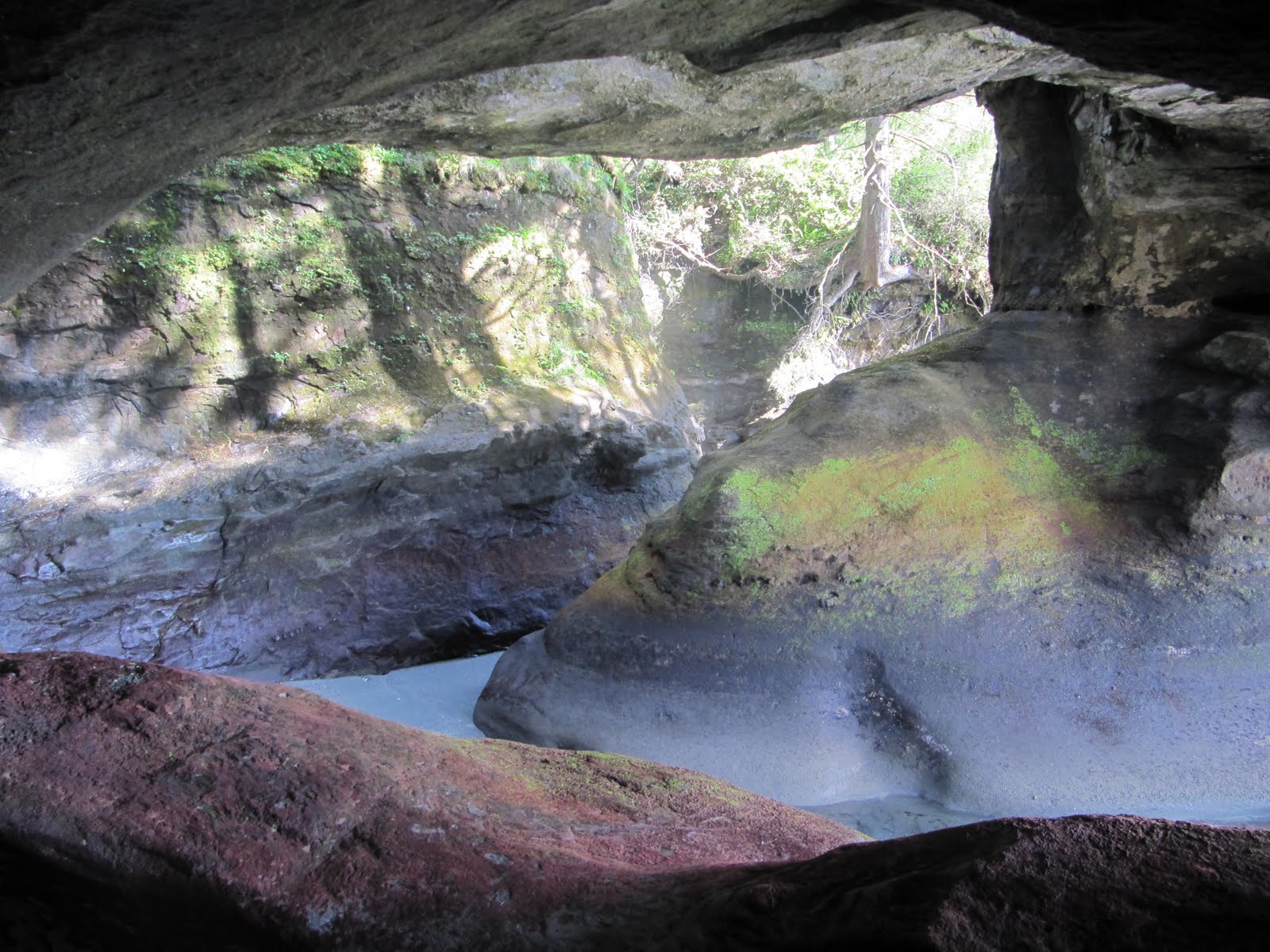
We woke up really early to another sunny day to make Owen's Point by 8am, which is when tides are the lowest. Owen's Point is along the beach, and it has tunnels that are only accessible at low tides. As we were walking along the beach, there were some very large gaps that we had to jump over, and if we slipped, we would've fallen a good 40 feet into some water with no easy way out. The gaps were maybe 4 feet, but it's far with your pack on and jumping from one slippery rock to another. We each had our fair share of slips and falls along the way, but we were very fortunate that they weren't at points where we would fall to our death - and no kidding, there were places where a single slip would've sent us over cliffs or far down to a rocky creek, and the terrain was filled with roots or slippery fallen trees that require your full concentration. At these points, we had a very strict "no falling" rule that we reminded each other on. I meant to ask how many people have died on this trail and consequently the survival rate, but I completely forgot.


The caves at Owen's Point were amazing, and we had a lot of fun climbing in, out, and around them for a while. The next part of the trip involved climbing around large boulders and rocks, which required a lot of patience, planning and leaps of faith. They were difficult to navigate around, and some were very slippery. There was a seal that kept following us along the way and popped his head out a couple of times, but every time I tried pointing it out to Nicole, she couldn't see because there were boulders in the way. It kind of felt like a Polkaroo situation. We met up with Sean and other hikers at the last campsite, and we said our goodbyes and headed for the last 5k of the trip. We were told that it would be the hardest part of the trip and it would take us 5 hours, but it only took us half the time. Maybe because we were expecting something brutally difficult, but to me it didn't seem as bad as everyone said it would be. By the end, we were all so exhausted and our legs seriously felt like lead weights. Hiking with these packs is definitely more exhausting than cycling through the mountains.

After finishing, Rinita came to pick us up and we headed to her place in Port Renfrew. Rinita has been so nice to us to go out of her way to help us, and seeing her and a real shelter was a very welcoming sight. We spent the rest of the evening with her, playing Oh Shit (card game) and relaxing. It was nice to go to sleep in a bed.

That's family!

I got up this morning to another beautiful morning. I was so cozy in my sleeping bag, and the air was so nice and fresh that I didn't want to get up, but we had to meet up with Travis today so we could get started on the West Coast Trail. I was a bit sore this morning, but after walking around a bit it went away.As we were cycling along the highway, everyone was warning us about the Malahat - a mountain just south of Mill Bay. I guess it was because we were so mentally prepared for it, but it didn't seem too difficult. Sure, it was relatively steep and fairly long, but it didn't seem to compare to those summits near Port Alberni. Going down the mountain was a beauty. Steady downhills that lasted a long time. As we were heading in to Langford, the trees grew thick around us, and there was a gorge along the highway that was very beautiful and scenic. For the first time since we landed, it rained... only for 20 minutes, but I was forgetting that I was in BC with the lack of rain we've lucked out on.
We arrived in Saanich to meet up with Travis at his brother's place by 3:30 pm. His brother, Derek, is on the National Rowing Team, and he was planning on having a bunch of naitonal team guys over for a bbq and a celebration since they figured out who will make the team for Worlds through a tough regiment of seat racing. When they figured out that Travis and Derek were brothers, they kept on saying "Oh man, that's family"; and when they found out that Nicole and I were twins, they extended that to everything. Shotgunning bear (opening it with a huge knife or teeth) - that's family; tossing around a cantaloupe and taking bites out of it after it cracks open - that's family. They were an absolute riot!

It was also pretty cool that they told us that were were intense for doing this trip. I mean, here are monsters of human beings, who wake up super early and row three times a day, six days a week, and some of them already have gold medals from the 2008 Olympics, telling us that we were hardcore. It was a pretty cool feeling.


Fun facts, stats and lessons learned

Distance travelled today: 82.08 km

Total distance travelled: 332.08 km

Starting point: Chemainus River Campground, in Chemainus.

Our Route: Took Highway 1 all the way to Helmcken Road in View Royale, which turned into Wilkinson Road, and then went North on Highway 17 and turned off on Haliburton road, where Derek resides. All roads have decent shoulders, except when passing through Duncan, and on Helmcken/Wilkinson where the bike path seemed to start and end at every block.

Ending point: Derek O'Farrell's place, in Saanich.


  • Malahat summit is 352 m.
  • We biked to the grocery store after taking all our gear off. The bike felt as unstable as the first time we put on the gear.

Nanaimo bars!

We got up, and we decided to take a short walk along Cathedral Grove. The trees were impressive, but the trail was very short so were able to start cycling early. Today was the first day that it felt real that we're actually cycling this country. Yesterday was a long bike ride, but to wake up early and do it again the next day was a different feeling. The roads were rolly, but mostly downhill, and a tailwind made the cycling very easy as we maintained 35 km/h for minutes at a time. It was a bit scary when we went on Highway 19 since the speed limit is 110 km/h and it had a small shoulder. It was especially intimidating as large trucks zoomed by, but I got used to it after a while and it was fine. A few days ago I was worried that we wouldn't even be able to start our trip since Nicole was very wobbly on her bike and kept on saying "I can't do this." But with a little rearranging of equipment (put the heavier stuff towards the bottom of the panniers) and time, I even got comfortable enough to stand up while going uphill.

As we completely underestimated the time it took to get to Port Alberni, we overestimated the time it would take to get to Nanaimo.

We were excited.

We decided it would be a great idea to stop for a while and air out our equipment, take showers, and enjoy the sunshine! After getting Nanaimo bars at a local bakery, we're currently chilling out along the port boardwalk. The sun is shining again, people are strolling along and talking to us, and there is someone playing the guitar not too far away. Nanaimo is a cute town, with a downtown area with old style shoppes along well maintained brick roads.

We spent a full four hours in town, and left after the wonderful break. We were hoping to make it to Duncan, but we finally decided it would be best to stop in Chemainus instead of trying to find a place in the dark.


Fun facts, stats and lessons learned

Distance travelled today: 104.20 km

Total distance travelled: 250.00 km

Starting point: MacMillan Provincial Park, along the side of the road near Cathedral Grove.

Our Route: Took Highway 4 to Highway 4a in Coombs, which led to Highway 19 (Inland Island Highway). Just before Nanaimo, the Highway split and we took Highway 19a (Island Highway) into the town. As we were cycling along, we found a bike path that ran parallel with the highway, so we switched over and it took us straight downtown. Leaving Nanaimo, we went back onto Terminal Road, which led to Highway 1. The shoulders have been decent, and the roads are in very good condition with the exception that there are frequent encounters with patches of rocks/pebbles.

Ending point: Chemainus River Campground, in Chemainus.


  • MacMillan Park contains some of the only remaining old growth coastal Douglas-fir in Canada.
  • During high winds, people should evacuate the hiking trails immediately.
  • There is no "must go" shop to get Nanaimo bars.
  • Many BC campgrounds, if you show up after the office closes, will let you stay on an empty site for the night and you pay in the morning.
  • When following someone, there's a tradeoff between drafting and being able to see potholes or debris ahead. I found it most effective to draft on the flats, but leave space on the downhills.
  • Having that extra small front chainring helps a lot on the uphills. I am much faster than Nicole since she only has two up front.
  • There is no sales tax on bikes sold in BC.
  • Nicole and I could demolish 1 kg of trail mix as if it were an in-between-meal snack.

The long and winding road

The Pacific Rim Highway is very hilly. There are plenty of terrible uphills and downhills. Just before heading out for the day, we stopped to ask a construction worker what to expect up ahead, and he said that there was this big hill named Hydro Hill. He said "[we] will know when we hit Hydro Hill" … and we did. They don't just give any hill a name in this neck of the woods. It was very steep, windy, and seemed to go on forever. I was in my lowest gear (on a mountain bike!) going less than 4 km/h, but I rode the whole thing. You would’ve been proud if you seen it – with the gear and a headwind too. There was another major hill heading east out of Port Alberni. This one wasn't as steep, but it lasted for over 9 km (no joke - we measured it on our odometer!). The worst part was that we could only see about 400 metres ahead of us, and it seemed to peak just around the corner, but we were wrong and disappointed far too often.

It wouldn’t be fair to talk about the uphills without the downhills. The one coming down from Hydro Hill was a solid 18% grade. On many of the downhills, we had to go onto the main road since it was far too windy and we were going too fast to safely make our way to the bottom along the shoulder, if there was one at all. Many stretches up/down a mountain had a rock face on one side, and a steep drop on the other, with a visibility of around 50-200 m. But somehow we lucked out with the traffic and there were no cars behind us as we zoomed down the hills. Just past Hydro Hill, I hit a max speed of 58.3 km/h in a headwind and using my breaks, and I tried to slow down because I realized that if a gust of wind came from my side, I would've been thrown off my bike and sprawled along a 100 m stretch of the highway, maybe not in one piece. We had a headwind all day, which made some of the downhills feel like uphills. It wasn’t a strong headwind, but it was consistent and we definitely felt it. It seemed to take forever to get to Port Alberni, which at first we thought we could make on our first full day of cycling. Port Alberni is a quaint little town, with nice people that like to chat us up. We enjoyed talking with them for a bit, but since we were on a bit of a deadline to meet up with Travis in Victoria and we wanted to find a place to stay for the night that I got a little impatient. We weren't rude to them, but it made me think that maybe people think that Torontonians seem unfriendly since we're used to direct, efficient answers.

After Port Alberni, we were looking for a place to camp as we cycled down the summit. We wanted to camp by 6-7 pm every night so we're sure we don't get stranded in the dark without a tent pitched or a place to stay. We ended up in MacMillan Provincial Park, but camped behind a concrete barrier after a river. The forest is starting to look like a BC forest in this area, with tall trees and the moss that is on almost all the branches. It was a solid day of cycling, and we get to do it again tomorrow.


Fun facts, stats and lessons learned

Distance travelled today: 99.31 km

Total distance travelled: 145.80 km

Starting point: somewhere along the east side of Kennedy Lake, by the side of the road.

Our Route: Took Highway 4 into Port Alberni, turned left at Johnston Road, and continued on Highway 4. The roads were in excellent condition, although there was no shoulder for the first 50 km (which could've been very dangerous), then a small shoulder, then a decent shoulder as we approached and left Port Alberni. The only place with a less than great stretch of road is the 10 km leading into Port Alberni from the west, where there were plenty of potholes, cracks, no shoulder and lots of traffic.

Ending point: MacMillan Provincial Park, along the side of the road near Cathedral Grove.

  • Summited 2 peaks today. Summit west of port Alberni: 240 m; summit east of Port Alberni: 411 m.
  • Maximum speed: 58.3 km/h.
  • Vehicles must wear winter tires or chains from October 1 - April 30 along these roads. That's just a week ago. We really lucked out with the weather.

  • Saw two black bears today along the side of the road, grazing along and eating. We were no less than 30 m from one of them.

Surf's up, dude!

Last night we stayed at Bella Pacifica Campground on Mackenzie Beach, and again, we were late to leave the site. We got up at 6am, but because we were still figuring out our gear arrangements, we cooked our breakfast, and we had some unforeseeable mishaps (I had a flat in my sleeping mat), we didn’t end up leaving until 10 am.
We were set on going surfing in Tofino, and this ended up being the perfect day to do it! After walking into town to rent gear, we took a cab to Cox Bay to surf. The scene was incredible – blue skies all around, waves crashing into the shore from the oceanfront (not too big, but perfect for beginners like me and Nicole), and a really warm sun on our backs. Nicole did do surfing once in New Zealand, and so she was trying to tell me how to stand on the board. We must’ve looked ridiculous! We kept on trying to stand on our board, wipe out with flailing arms, laugh about it and then eagerly getting back onto our board for the next wave. Even though they were all short lived, both Nicole and I managed to stand on our board a few times by the end! Take that surfing lesson! There were so many places offering lessons, but I’m glad we didn’t go with them because I had so much fun just fooling around with the surfboard anyways!

Today we started biking. We didn’t leave until 3:30pm, but we still managed to go a fair distance. There were short but rolly hills along the Pacific Rim, and a tail wind really did us well. Some points were very interesting as on both sides of the highway was a forest so thick that it seemed like it was nighttime only a few metres away. We stopped at the side of the road along Kennedy Lake to set up camp before it got dark and to not push it too hard on our first day of biking. I’m about to go to sleep soon, as the sun is setting over the mountains. There’s a small waterfall on our right, and the sound of the lake on our left. It felt good to just pause for a minute and try to take it all in.


Fun facts, stats and lessons learned

Distance travelled today: 46.495 km

Total distance travelled: 46.495 km

Starting point: Tofino (Bella Pacifica Campground)

Our Route: Took The Trans Canada Highway the entire way. There was a bike path along most of the Pacific Rim Highway (Highway 4), and a shoulder after the junction with the Ucluelet Tofino Highway. Road conditions were excellent.

Ending point: somewhere along the east side of Kennedy Lake, by the side of the road.

  • We should not have bought as much food as we did. We bought way too much food in Tofino because I thought that it’s better to be safe than sorry (We have enough to last us to Victoria). Big mistake when trying to carrry it all on our bikes! We got a lot of fresh food too, which definitely weighs us down. Next time, stock up on the dried foods, and just buy enough fresh food for the day.
  • Nicole found her gear very top heavy, and I was stronger on the uphills. We’re going to try an arrangement tomorrow where I will get more heavy gear, and I will be drafting off of her the whole way.

Will it fit?

This morning we got up and sorted out all our gear. I was very worried at first that it wouldn't all fit in our packs. I picked up my front and rear panniers at the MEC in Vancouver on the way to the bus station, so I had no opportunity to see if I would be able to carry everything. On top of that, every time I spoke with Nicole prior to leaving, she kept telling me "I hope there's room in your panniers because there isn't in mine for everything I have." Of course, she did have most of the communal gear. It took all morning to sort out the stuff, and we were very surprised to find out that... it all fit!!! Just have a look at Nicole's blog to see what gear we brought. One interesting thing to note is that I packed fewer clothes for this four month expedition than I usually do for a weekend regatta. Hygene is overrated anyways, right?

It was a very nice, sunny day, so we took a stroll into Tofino. We were hoping to go surfing, but we spent too much time on packing our gear that we were too late for the surfing. So instead we did our grocery shopping for the next couple of days, and after going through the checkout, we realized that this might last us until Victoria!
We're chilling right now at the Field Station, even though we've checked out already, and just as I'm posting this, the school that is staying here made too much food and wants to feed us dinner! I'm going to enjoy that right now! Tonight we camp for the first time; let's see how well prepared we are for this! Tomorrow we start cycling.